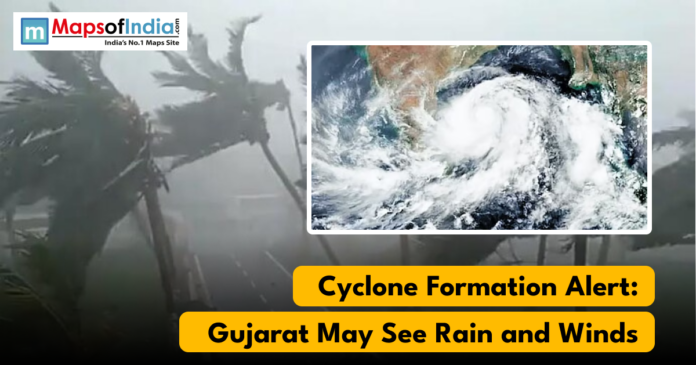
Met Meteorological reports indicate that a new weather system that is forming in the Bay of Bengal will become a cyclone within the next 24-48 hours. Although the system is concentrated in the southeastern area of the Bay at present, its formation is expected to affect the weather conditions in a number of areas in India, including Gujarat. Despite the fact that Gujarat is not supposed to experience the direct cyclone landfall at this point, the state can experience the indirect effects of weather, which include a shift in temperature, cloud formation, increased wind velocity, or random rain.
The low-pressure system, which is currently developing, is expected to intensify progressively into a depression and could possibly develop into a named cyclone within the next two days. The extrapolated path has indicated that the system might shift to the eastern states, such as Tamil Nadu or Andhra Pradesh. Yet high-altitude weather systems can be relatively widespread in the atmosphere, and this one can interfere with the patterns of winter in western India, such as Gujarat.
Today, there has been a steady fall in the temperature of Gujarat, particularly in early mornings and the evening. The cold wave has already established itself in a number of areas, and the day-night temperature is shifting very noticeably. According to weather experts, the approaching cyclone may either enhance the cold wave or temporarily ease the cold wave on a temporary basis, depending on the way the larger atmospheric circulation changes during the next couple of days.
Development of clouds and light wind can also be experienced in some of the districts in Gujarat as the system gains strength in the Bay. The coastal regions, especially in Saurashtra and Kutch, are likely to witness more marine precaution because of the evolving sea levels. There is a recommendation that fishermen must remain vigilant and pay attention to frequent updates in case the speed of the wind rises with the deepening depression.
Nevertheless, analysts have pointed out that the state of affairs is dynamic. The formation, intensification and subsequent direction of the cyclones can change tremendously within a limited timeframe. Law enforcers are keeping a close eye on forecasts issued by the India Meteorological Department (IMD) and other weather models, as they will have more accurate forecasts as the system progresses. Currently, no significant warning is raised in Gujarat, but the shifting weather pattern can still have an effect on temperature trends and the local climatic behaviour over the course of the week.
The residents have been encouraged to monitor predictions, particularly in coastal areas and listen to official recommendations as they come out. Though the cyclone threat is seen as a more immediate issue to the southeastern states on the coastline, the developing system repeats yet again how the tropical weather in the Bay of Bengal can affect areas that are well further than their landfall.


